Using Linear Referencing
Problem: You are to depict the number of accidents in relation to road conditions along a stretch of highway in Pitt County, NC to help understand if poor highway conditions are contributing to accidents.
Analysis Procedures:
Strategies and Methods: I performed Linear Referencing in Arc Map (version 10.5.1) to perform this analysis, as well as using Arc Catalog to examine the routes data, which has been provided. The data consist of accident information and pavement characteristics. I used the Make Route Event Layer tool to create layers for both the databases (accidents and pavement characteristics). I used the Select by Attributes tool to select sections of the highway with better rating and with poorer rating, and calculated the length of these sections. I used the Overlay Route Events tool to intersect the tables of the two layers and then made another Route Event Layer with this new, intersected table. I was then able to use the Select by Attributes tool to select accidents that occurred in poorer road conditions/rating and accidents that occurred along stretches of better road conditions. I now had all the information needed to calculate the number of accidents per mile under both conditions to determine if road condition may be related to accidents (Fig. 1).
Workflow Diagram:
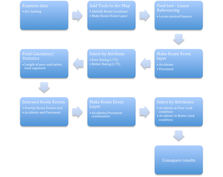
Fig. 1. Workflow diagram for performing linear referencing.
Results: Linear Referencing allowed a method of combining data into a single layer that varied at different spatial extents. The rate of accidents along sections of road with poor rating was 1.6 accidents per mile, while along sections with a better pavement rating, there were 1.7 accidents per mile (Fig. 2). Road quality does not appear to be related to the frequency of accidents along this stretch of highway.

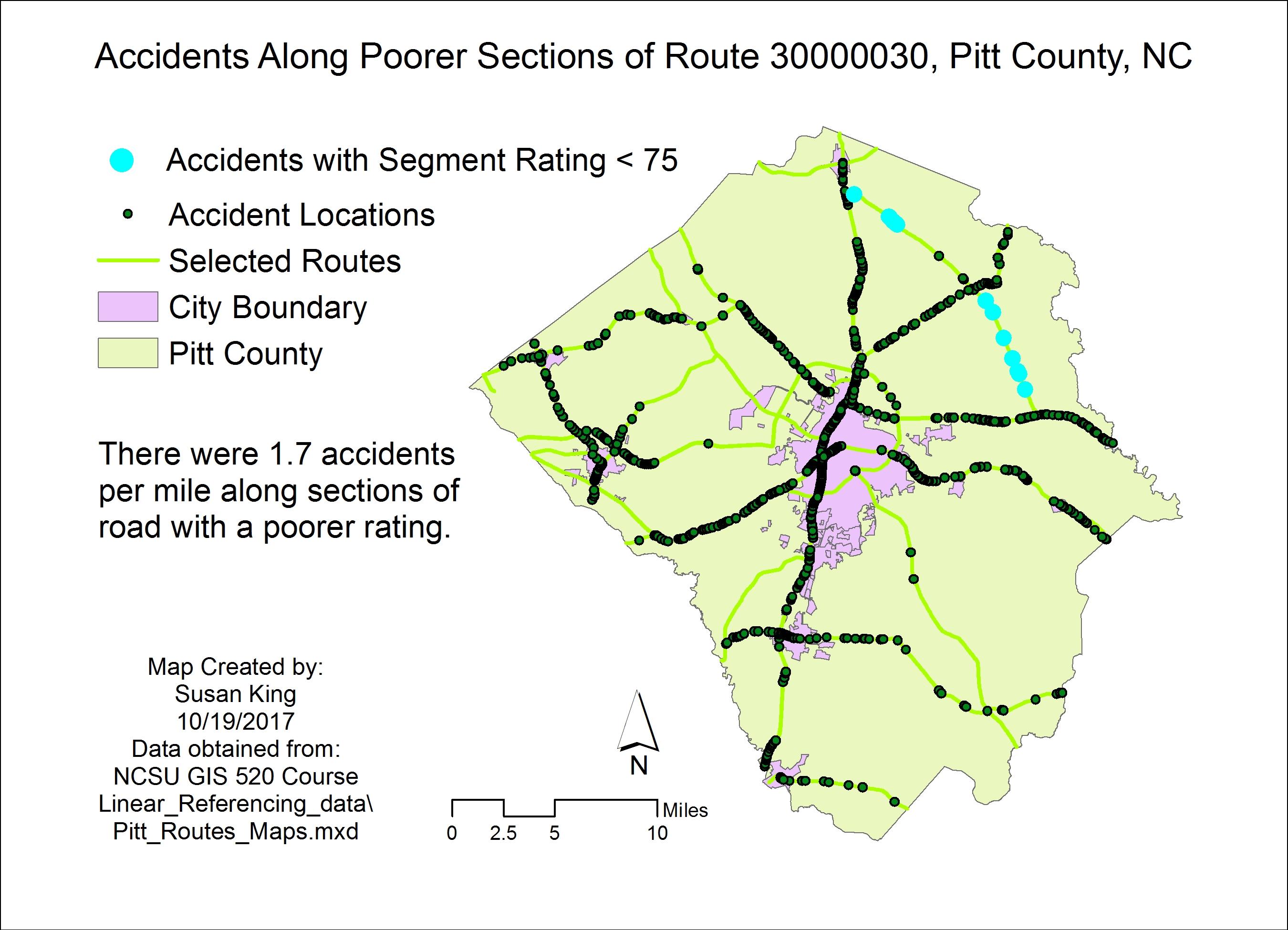
Fig. 2. Location of accidents along a section of highway in Pitt County, NC with better rating (left/top) and poorer rating (right/bottom) do not differ in frequency. Click on each image for larger version.
Application and Reflection: Linear Referencing provides a powerful tool to increase the ‘depth’ of the attributes of the features. This tool is designed to be used with linear features and is often used with road features.
Problem Description: You are studying the ecology of various ant species across a wide variety of habitats throughout the world. You are seeking a method of combining datasets with features that vary at different spatial extents so that you can analyze the environmental characteristics in which each species of ant is located.
Data needed: You are an ecologist and you have data that was collected along transects, which includes information on temperature, elevation, plant cover, ant species collected, and time of day.
Analysis Procedures: You begin by making route event layers for the ant species and for the desired ecological data. This information could then be overlaid to combine various features into one table and a new event layer could be created to search, analyze, and display the results.
